An incomplete list of disappeared places
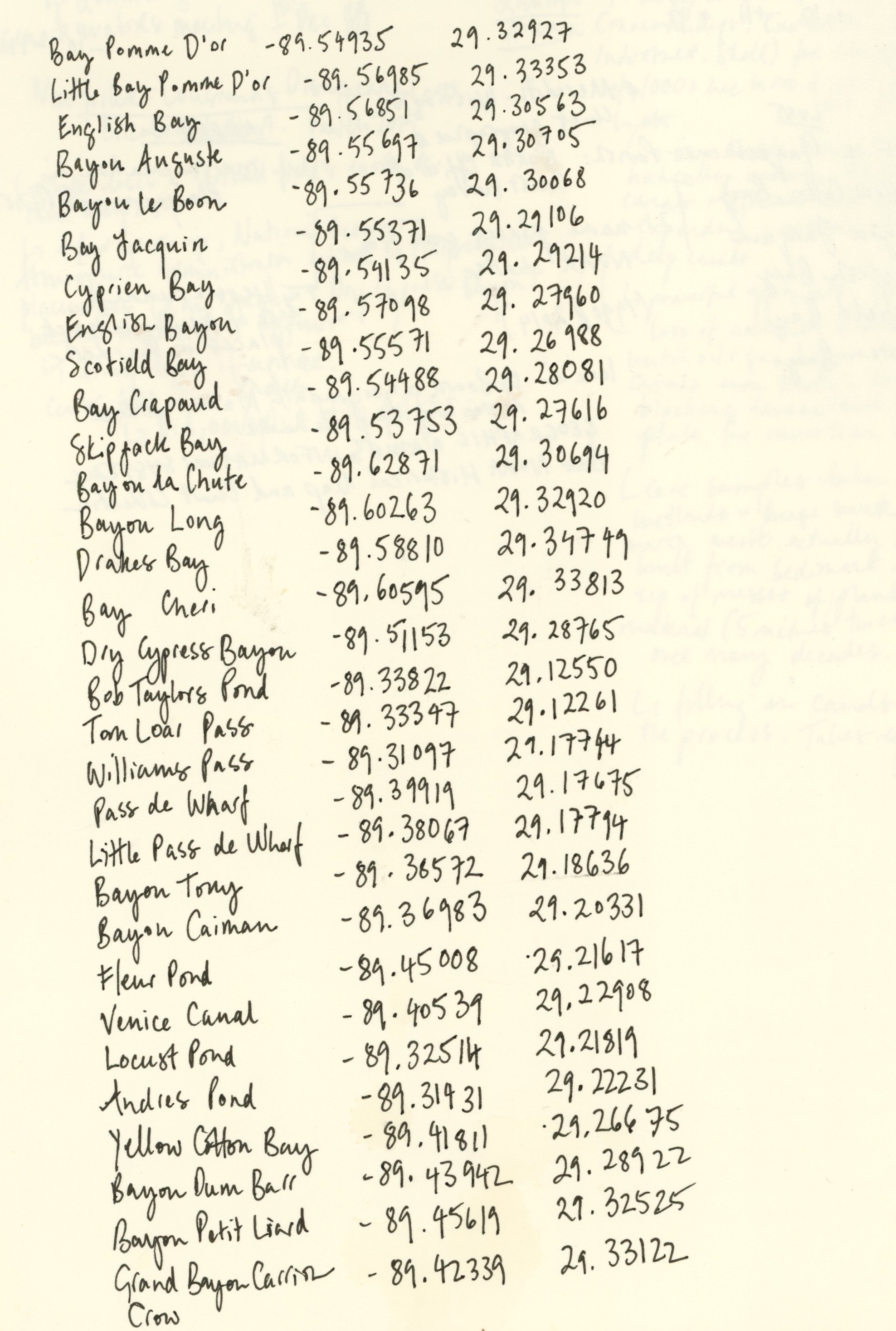
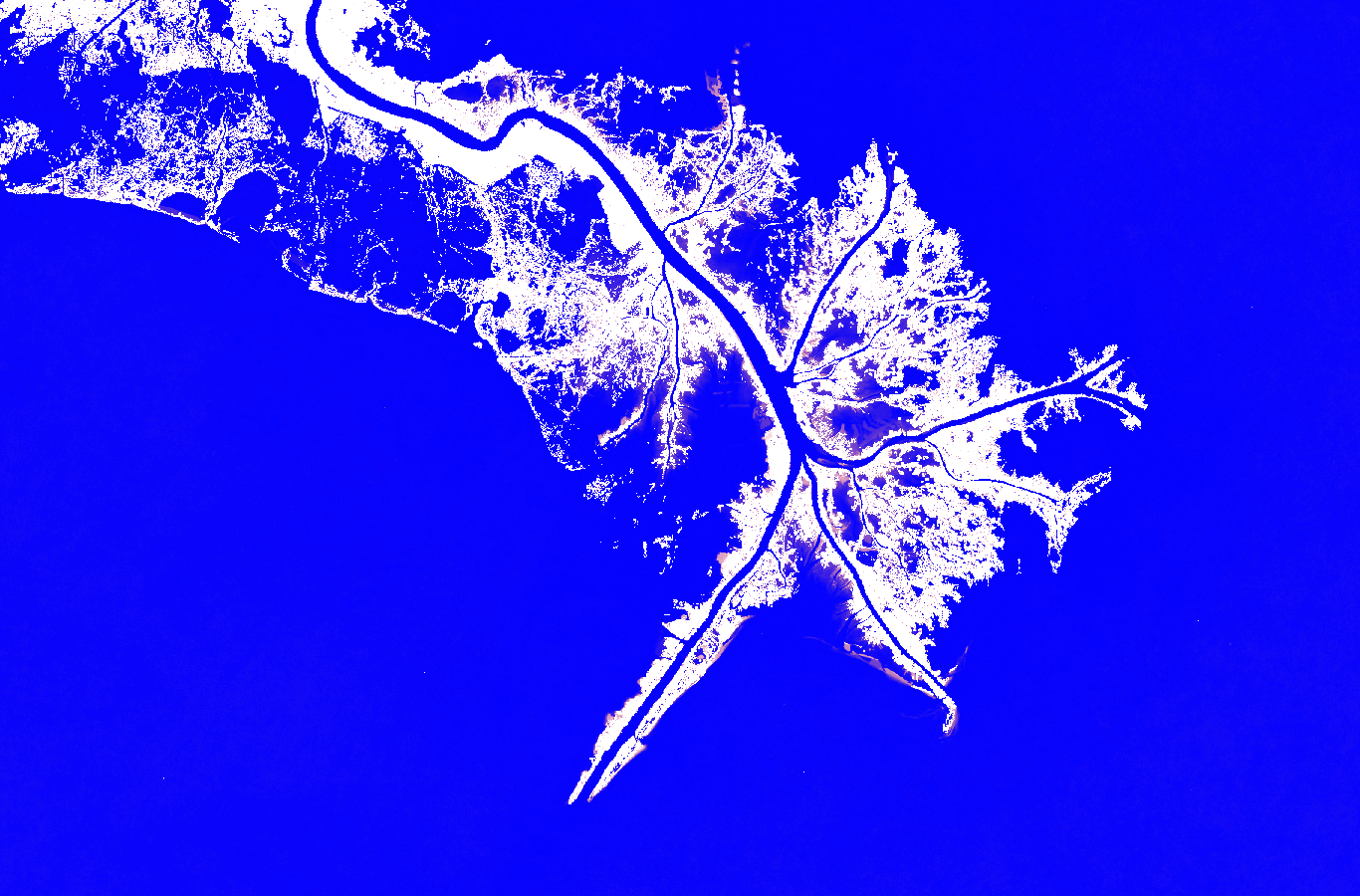
This work consists of a handwritten list of place names in Louisiana - islands, inlets and bays - that once appeared on maps but have since been removed as the coastline has eroded. By recording and recording the names that no longer correspond to the physical world, the drawing demonstrates how technological systems of mapping struggle to register rapid environmental change. Mapping practices are changing in response both to environmental transformation and technological shift. Coastlines were once surveyed manually but are now primarily mapped through aerial photography and satellite imagery. In the USA, this responsibility falls to the National Oceanic and Atmospheric Administration (as part of the Office of Coast Survey) but the agency has undergone significant restructuring as part of Trump’s deprioritising of scientific research and it is unclear whether it still has the capacity to monitor change. It also points to the inherent instability of mapping in the region. Because much of the Louisiana coastline is marshland, maps sometimes mark the limits of vegetation rather than the presence of solid ground because of the lack of hard data. This is worsened with climate change and there are many anecdotal stories of GPS systems identifying a location as land long after it has disappeared beneath water.
Artist Notes (Thoughts & Process)