Cypress_07._lowjpg.jpg

Cypress Trees: Fragmentation

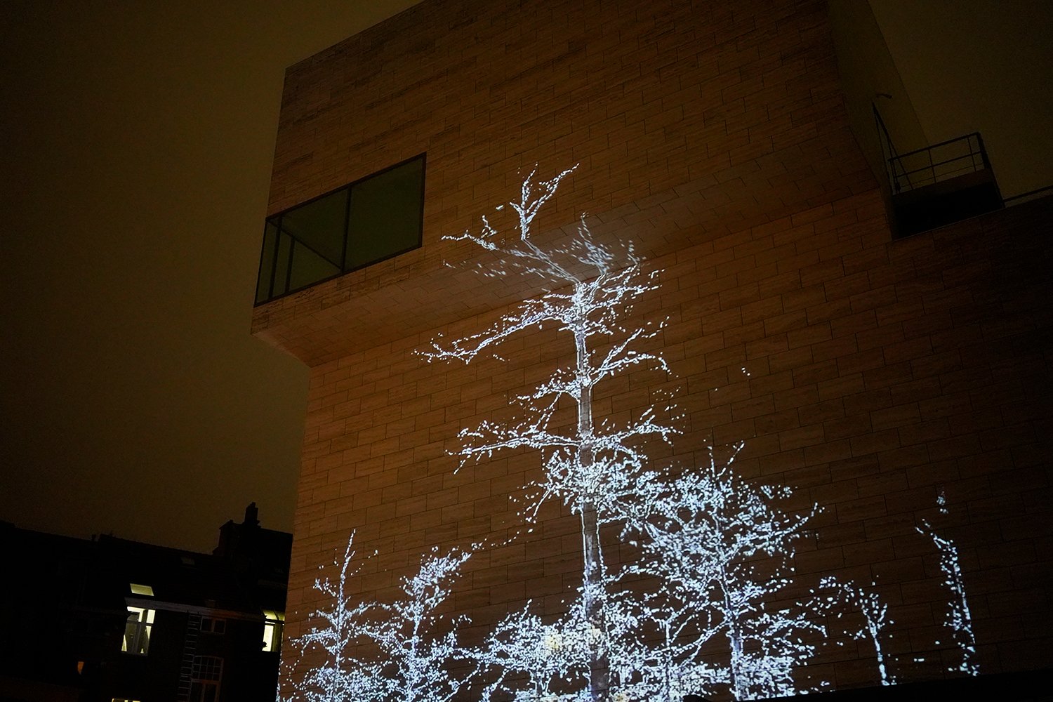
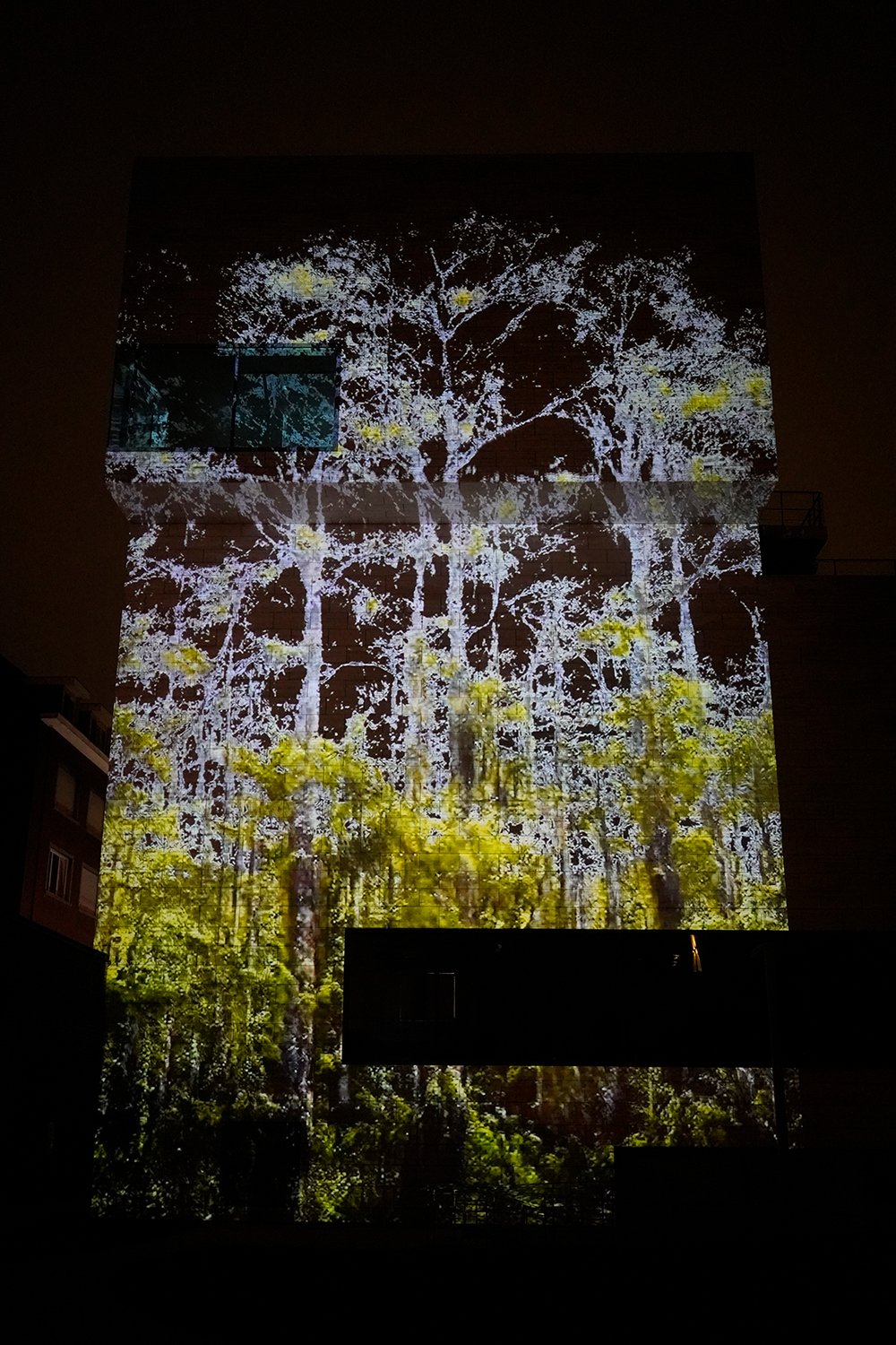
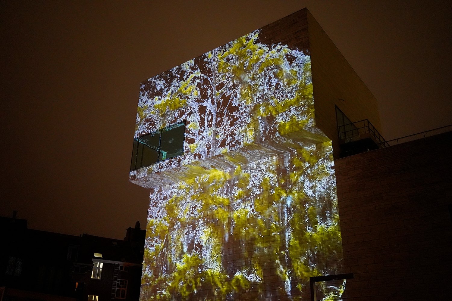
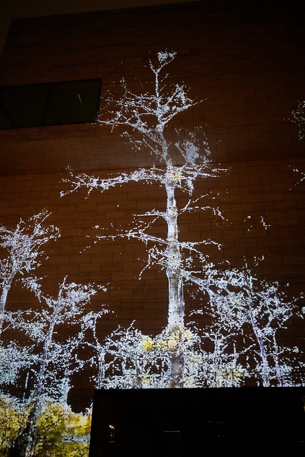
Cypress Trees: Fragmentation, 2021

with Caroline Sinders

Projection, GAN video (30:00)
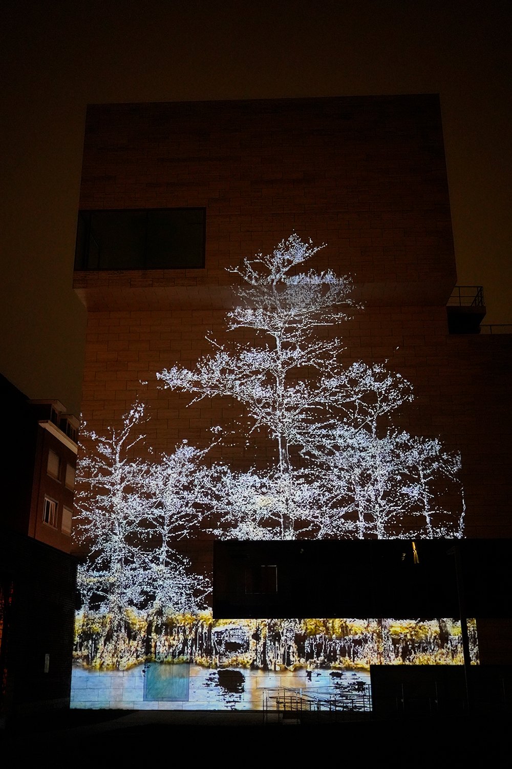
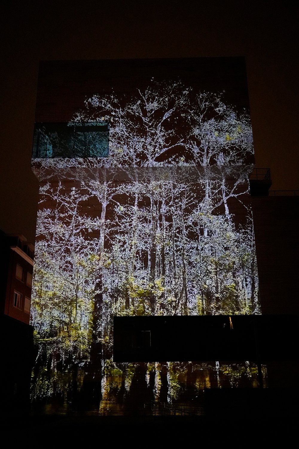
Research & Process

IMG_8682.jpeg
Hnet-image.gif
racoon.gif
Early epoch of GAN output

Early epoch of GAN output

IMG_8685.jpeg
The distribution of oil and gas well permits issued between 1900 and 2017 that were ‘plugged’ or ‘abandoned’ in 2017 and on land in the 14 parishes. - https://www.ncbi.nlm.nih.gov/pmc/articles/PMC6294348/

The distribution of oil and gas well permits issued between 1900 and 2017 that were ‘plugged’ or ‘abandoned’ in 2017 and on land in the 14 parishes. - https://www.ncbi.nlm.nih.gov/pmc/articles/PMC6294348/

There has long been a connection between technology and big oil

There has long been a connection between technology and big oil

Suit was filed in 2013 by the Southeast Louisiana Flood Protection Authority-East, accused more than 90 companies (inc BP Plc , Exxon Mobil Corp, Chevron Corp and Royal Dutch Shell Plc) of destroying the state’s fragile wetlands that protect the gre…
Screenshot 2020-11-23 at 13.16.40.png
Screenshot 2020-11-23 at 13.16.06.png
Screenshot 2020-11-23 at 13.28.26.png
Cypress trees have evolved over millions of years - ADD HISTORY

Cypress trees have evolved over millions of years - ADD HISTORY

Names of the places that have disappeared in the past 15 years (incomplete) PROJECT: FiND ALL NAMES OF PLACES THAT WILL DISAPPEAR IN THE NEXT 100 YEARS (& THE LOCATIONS OF THE NEW LANDS THAT ARE BEING RECREATED). 2 screens - one that has the dis…

Names of the places that have disappeared in the past 15 years (incomplete)

NOAA sea-level rise viewer: predicted sea-level rise, and flood frequency, march migration, population vulnerability and local scenarios.

NOAA sea-level rise viewer: predicted sea-level rise, and flood frequency, march migration, population vulnerability and local scenarios.

Screenshot 2020-11-23 at 12.21.51.png
Untitled-1_1.gif
Screenshot 2020-10-21 at 10.54.08.png
Mississippi delta sinking into the Gulf of Mexico. Blue is water, white is land, red shows areas of transition. (Source: EC JRC / Google) [from http://global-surface-water.appspot.com/map]

Mississippi delta sinking into the Gulf of Mexico. Blue is water, white is land, red shows areas of transition. (Source: EC JRC / Google) [from http://global-surface-water.appspot.com/map]

2009_Blum_Drowning of theMississippi Delta due to insufficient sediment supply-1.png
NGOM Storm Response Oblique Photography

NGOM Storm Response Oblique Photography