
Piece of the North Sea Port & Landscape of Finance, 2022

Commissioned by GLUON in partnership with LUCA School of Arts / Supported by and developed in collaboration with Farys, De Watergroep, North Sea Port, Antea Group, VLAKWA, VITO, Snowball / This project has received funding from S+T+ARTS (Science, Technology & the Arts), an initiative of the European Commission, launched under the Horizon 2020 research and innovation programme.
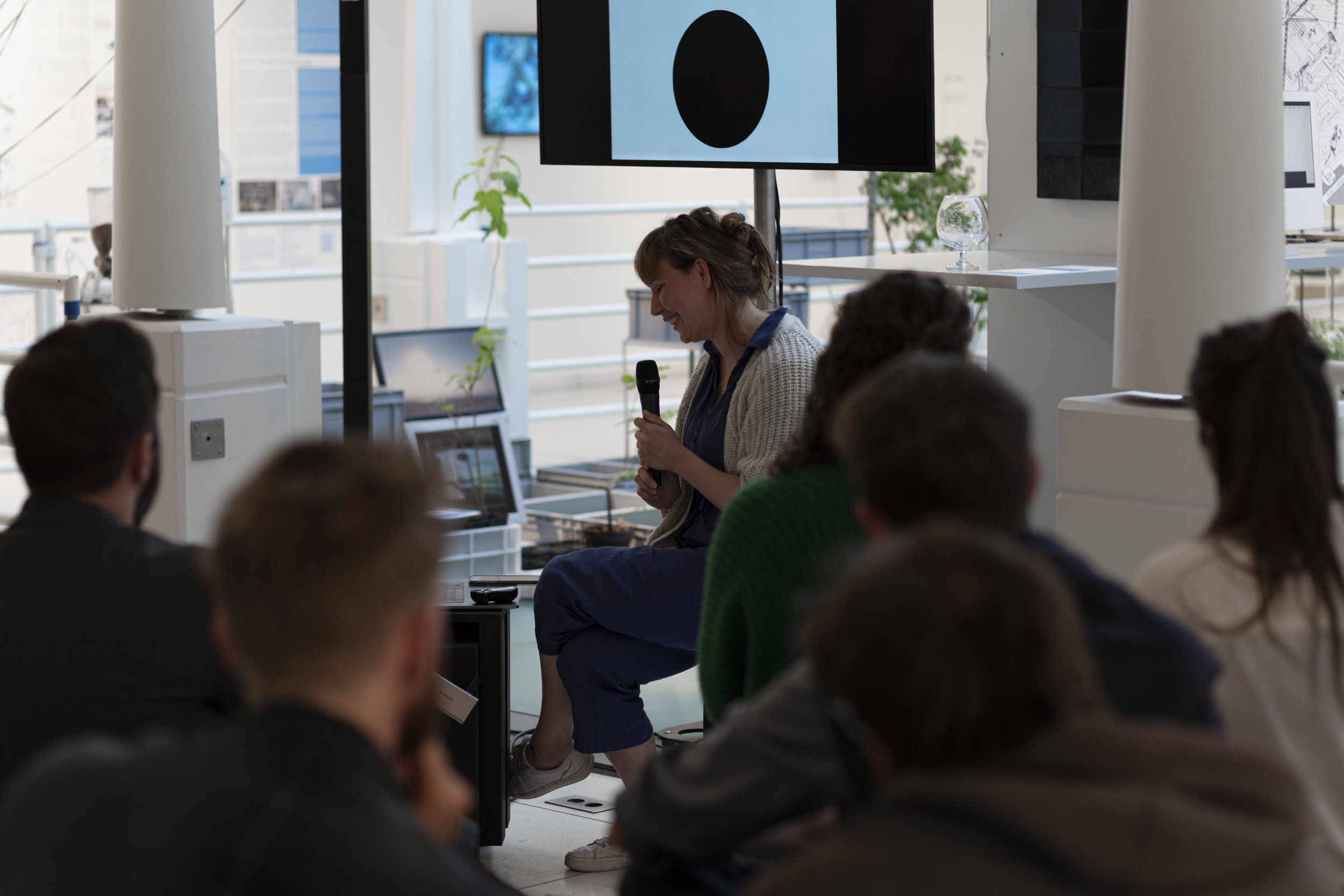
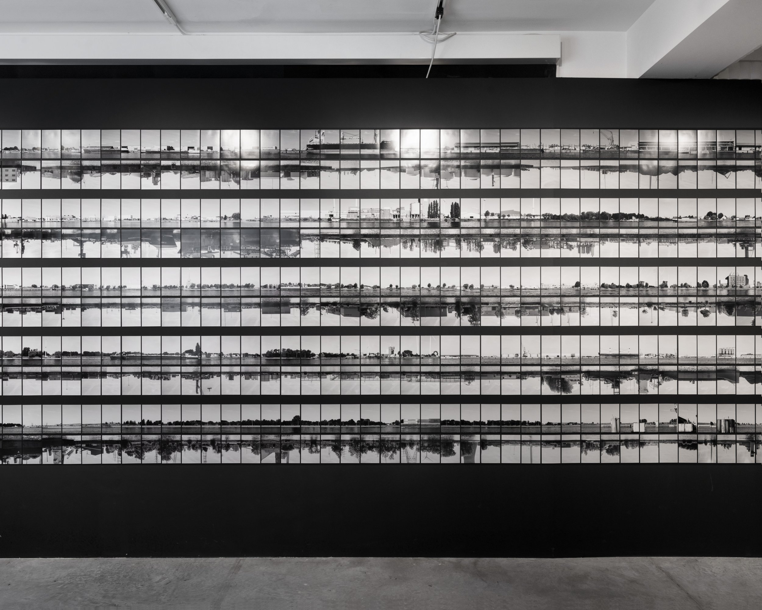
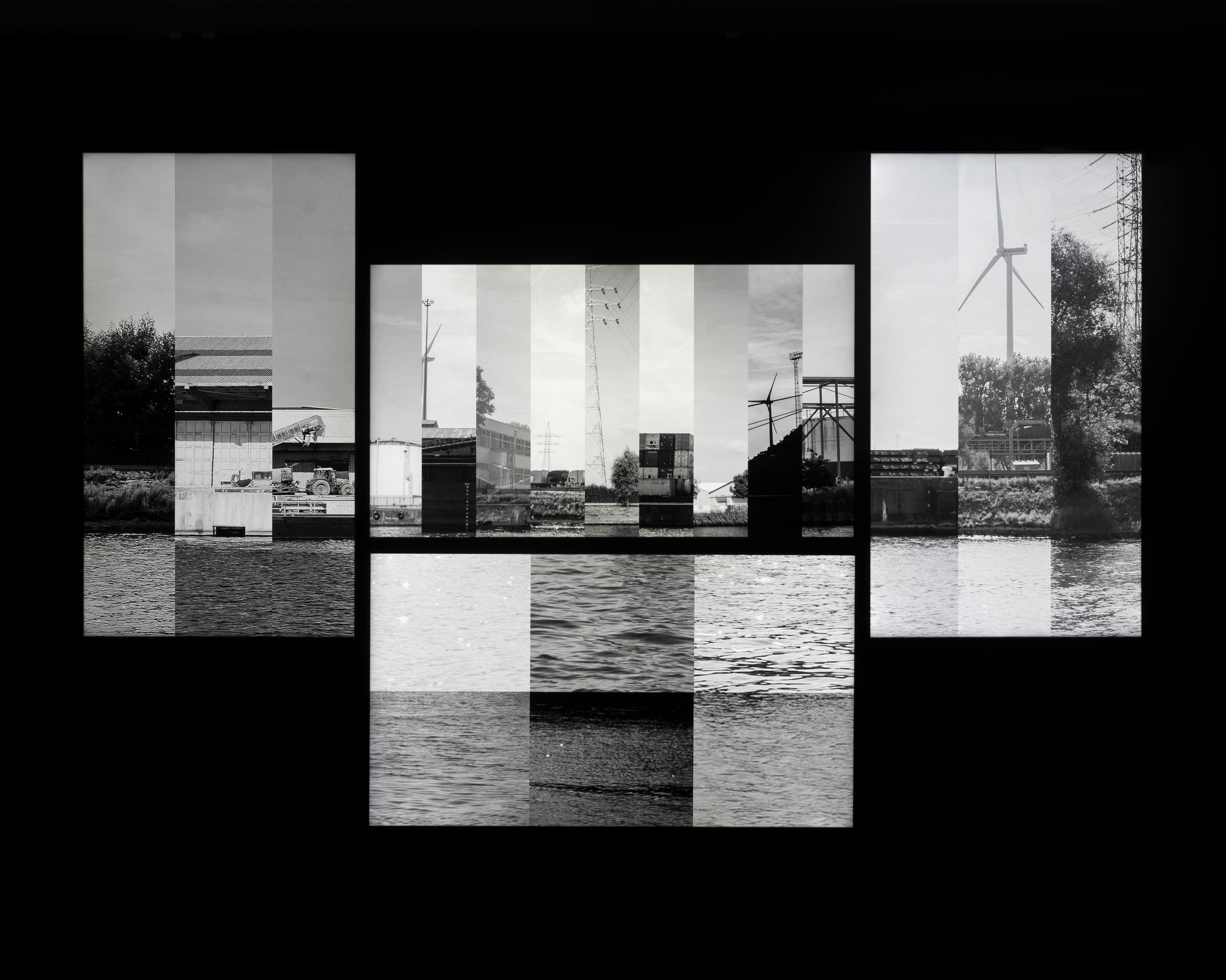
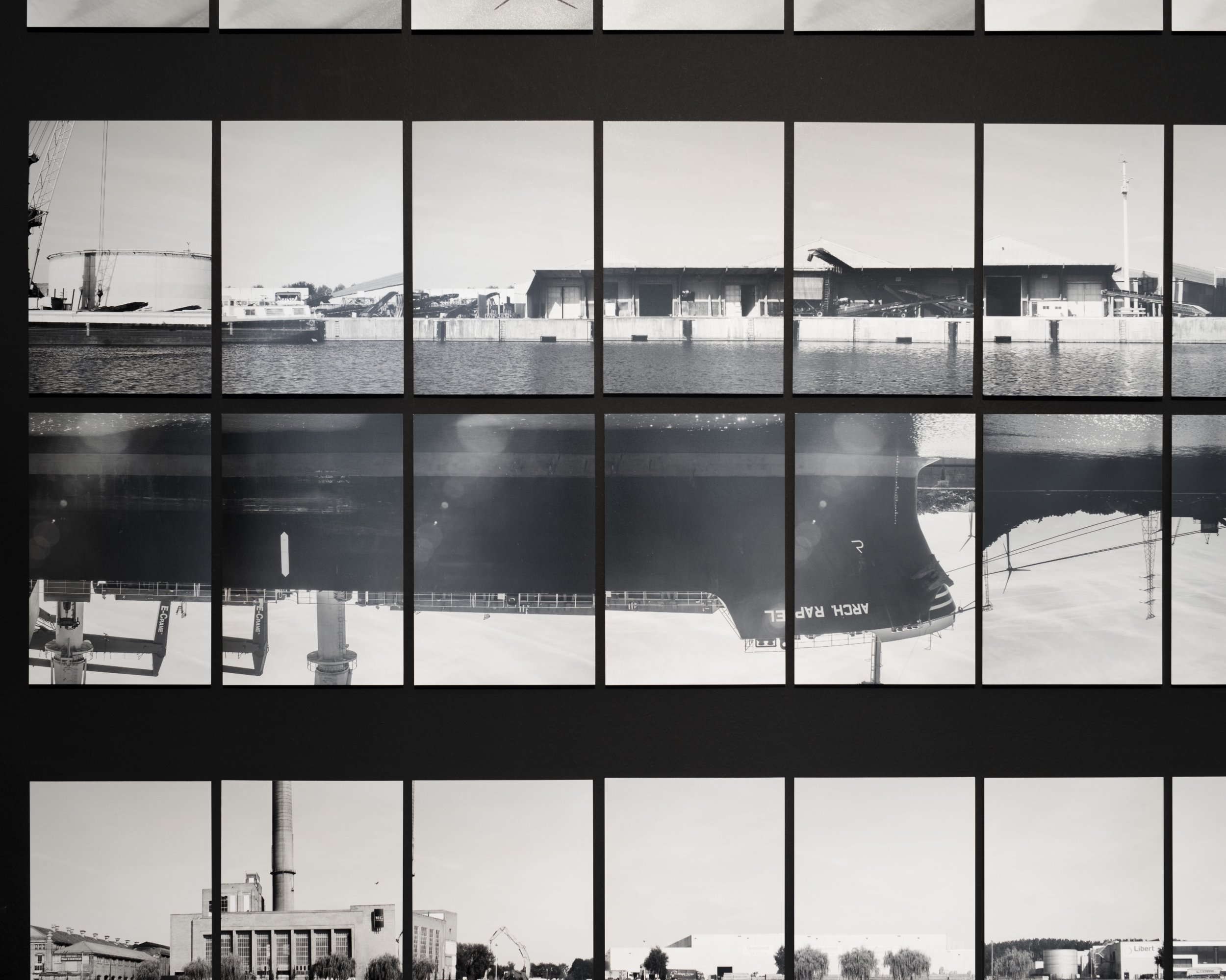
The “Water Capitalism” residency at Gluon exploring the eu directive around water management also looked at connections between capitalism, globalism, water management and the natural world and resulted in two works and a body of research. There is a layering of how water moves about in the region (the natural, the man-made, the industrial, the domestic all sitting on top of each other and interacting) and how this infrastructure is often obscured at the point of consumption and how things are not connected to what you see. “Pieces of the North Sea Port (August 2022)”, a large photographic dataset of over 800 images of each bank of the 31 kilometre-long Ghent-Terneuzen Canal - begins to push back against this. It shows the waterway and what is happening on it in a way that is otherwise very difficult to access, subtly integrating the flow of time, and visualising its different uses: from water used for transport/shipping to water used by its surroundings, such as nature, residencies and mainly industries. An inspiration for this dataset was an early map of Tournai which showed how all of these different uses exist together at once in a city. Rather than the gaps and lacunas that exist in Street View in Google Maps, this analogue representation of a digital technology shows a subjective recording of what is there. This dataset was then used to create a moving image displaying an alternative visual language of the stock market. Fragments of the photographic dataset are first cut in vertical strips, then assigned to different subjective categories connected to different uses of water, driven by the machinations of the stock market, presenting different possible landscapes depending on which types of stocks are doing well. Financial decisions made by people in global cities, without connections to the landscape, are flowing back into the local landscape.
These two works are part of a broader interest in how water was being manipulated in the Flanders region during the Middle Ages, to ensure everything from navigation, to flood protection, military defense to different industries, energy through to drinking water. Much of the research on the residency focussed on Ghent. At the time it was was crisscrossed with a myriad of river branches, ditches and canals and in 12th and 13th centuries a complex system of weirs, dams and dikes were constructed as a way to ‘tame’ the river, which led to it to become an important junction for inland shipping and a large prosperous city. This human intervention was carefully managed (polluting industries were located downstream, flood plains left for overflows). It’s interesting to compare this with what happened later: from the 19th century there was an intensified manipulation of water systems. Whereas before human interventions broadly worked with the natural patterns of waterways, from this point onwards water was really placed in top-down engineered systems. Looking at maps you can see how the landscape is inscribed by this: rivers straightened into channels, literally and figuratively. Flanders became the starting point for major freight transport through its inland waterways and even now the river and canal network is one of the densest in the world.